Vanoise: Walking (and running) around Pralognan
Posted by Sam Harrison on September 20, 2013 at 18:18.
alps fell running pralognan trekking vanoise
The spell of good weather we saw on the first week of our Alps trip wasn't to last, but that meant we got to really explore the area around Pralognan and do some fantastic walks and runs, a few of which I'll document here in the hope they'll be useful for someone travelling to the area. If "trekking" isn't your thing and Alpine summits are all you're after, then these ideas would make perfectly good acclimatisation days.
I've been up this mountain once before, on a holiday with my parents in 2005, and I made a point of returning as I remember thoroughly enjoying it the first time around. I'm not sure what gave me the idea to do it as a run instead of a walk, nor why I chose to do it the day after Dome de Sonnailles when my legs were still aching, but it definitely paid off! So, at 6am on Sunday, I found myself running up the track towards Les Prioux with a small bag containing a camera, one litre of water, windproof jacket, gloves, map and 300g of brioche. Similar to the previous morning (when we got rain on the summit of Dome de Sonnailles), a rather heavy shower passed through, but fortunately just as I had reached a particularly tree-covered part of the track, enabling me to take shelter. I reserved the first path up the mountain that I reached for the descent (which me and my Dad had descended 8 years prior), instead choosing the second route - the "sentier du foret" - a path that I hadn't been up before. The path zigzagged its way up the mountain for what seemed an eternity. It was excruciatingly runable; just at that angle that is too shallow to warrant walking but too steep to be comfortably runable. It took me an hour and forty minutes to ascend, only stopping once to re-tie my shoe laces. I spent a good few minutes on the summit admiring the views over to where we'd been in the previous week, eating my brioche and drinking most of the water, before heading off at speed to return back to the valley just within the "two hours from valley to summit and back" target I'd set myself.
I remembered the descent from 2005 as being steep, but I didn't remember it being quite as steep as it was! I struggled down in my Inov-8 fell shoes, which after a few years of solid use are becoming a little light on the tread. There was a fair bit of slipping and sliding, and a Lance Armstrong moment when I overcooked a corner and took the "short way" to the next zigzag through some bushes, but I eventually made it down in one piece. It was then just a case of struggling along the valley path back to the campsite for a cup of coffee and breakfast number two. Total time from campsite to summit and back: 2 hours 46 minutes.
The day after Petit Mont Blanc, the forecast was for thunderstorms in the afternoon and so any Alpine summit attempts were off the cards. Instead, we decided to do a walk and hopefully be off any exposed ground for when the storms hit. The Crete du Mont Charvet, a long ridge running north from Dents de la Portetta, is visible from Pralognan and caught our attention as a possible route earlier in the week. After checking the map it seemed completely plausible to do a loop encompassing Col de la Grande Pierre, Crete du Mont Charvet and Rocher de Villeneuve.
We followed an array of yellow signs from Pralognan to Col de la Grande Pierre, which offered a choice of routes in a number of places. We chose the "sentier du foret" in hope of shade, though it actually turned out to be mainly a large forest track through quite open ground rather than the little forest footpath we'd been hoping for. All the routes converge near "La Montagne", a little mountain village sitting underneath Crete du Mont Charvet, before making the ascent of the Couloir de la Grande Pierre to the col of the same name.
The "col" is one of those Alpine cols that isn't really that much lower than its adjoining ridge, and we only had a few more metres of ascent to do to gain the high point of the day on the Crete. We worked our way day the path that wound its way in, over and around obscure lunar-esque terrain, comprising many quartz ridges and craters with pine trees popping up at random locations. Word or photos don't do justice to how unique and interesting the Crete was; you really have to see it for yourself!
We were soon down at the Col du Golet and quick dashed up Rocher de Villeneuve before the ominous looking thunderclouds reached us. As we gained the summit, huge growls of thunder could be heard and impressive fork lightening could be seen striking peaks ever-closer to ours. In reality, we had plenty of time to get off the exposed ground, but being struck by lightening in the Alps last year was still fresh on my mind and we didn't hang about on the descent. The rain hit just as we reached a few little chalets, under the eves of which we took shelter. Fortunately, the worst of the storm skimmed past where we were and so we only got a bit of a shower, before enjoying the refreshing walk back down to Pralognan.
Immediately visible from Pralognan, rising in front of ominous Dents de la Portetta, is an opened topped grassy hill standing at 2185m. Whilst the hill is nameless on the map, the col between it and the aforementioned Dents is labelled the Col de Napremont, and it seems to me at least that this is the name used to refer to the hill as well. We'd been eyeing it up for a while and on one rainy morning I decided it was time to have a quick run up it. The plan was to approach it from the south and descend on the north side. However, after firstly running far too far up les Prioux valley and having to retrace my steps, I found a sign saying my chosen route was "closed" and had been for a number of years; they obviously haven't updated the maps yet! A good path lead from here up through the Bois de la Cholliere, and I'll leave it up to you to determine whether I obeyed the sign or not. However, for future reference, I would strongly advise anyone visiting to col to definitely obey the sign - whether I'm advising that from having been up it and regretting my decision, or simply looking down from the col over the extra-steep waist-high grassy slopes to the south, is your guess!
The northern route to the col was surprisingly varied, and a few days later, on another rainy afternoon, Lorna and myself went for a walk up there. It starts off by winding its way up through the forest, before throwing you out onto open slopes above on a zigzagging path that takes everything from boulder-strewn hillside to dense vegetation. We didn't have much of a view when we reached the top, but somehow that didn't really matter as the clouds shrouded the neighbouring hills made for an equally as impressive view.
The weather turned good once more for our final weekend in Pralognan, and so we decided to catch the bus to the neighbouring valley of Champagny to attempt Sommet de Bellecote. Unfortunately, however, Lorna's long-term hip injury started playing up on the walk in to the Refuge de Plaisance, and so instead we opted for a bivvy in the valley and the following morning I went for a walk up Pointe de la Véliere before we caught the bus back.
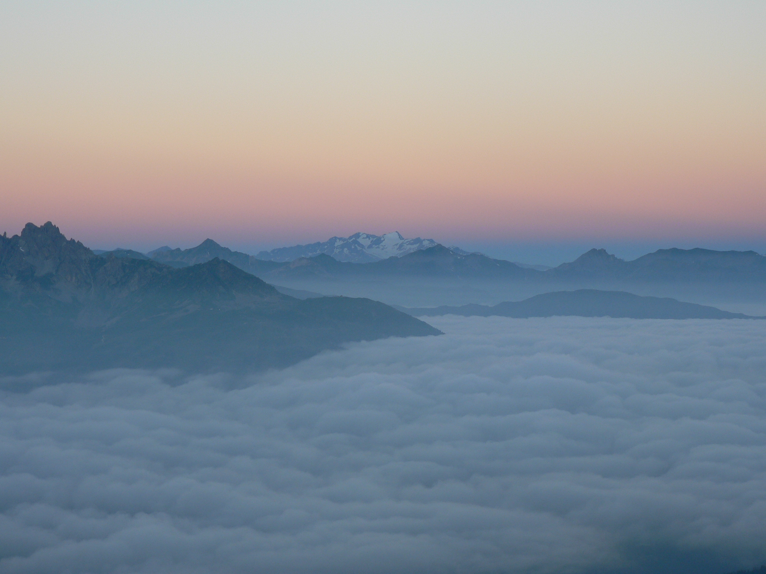
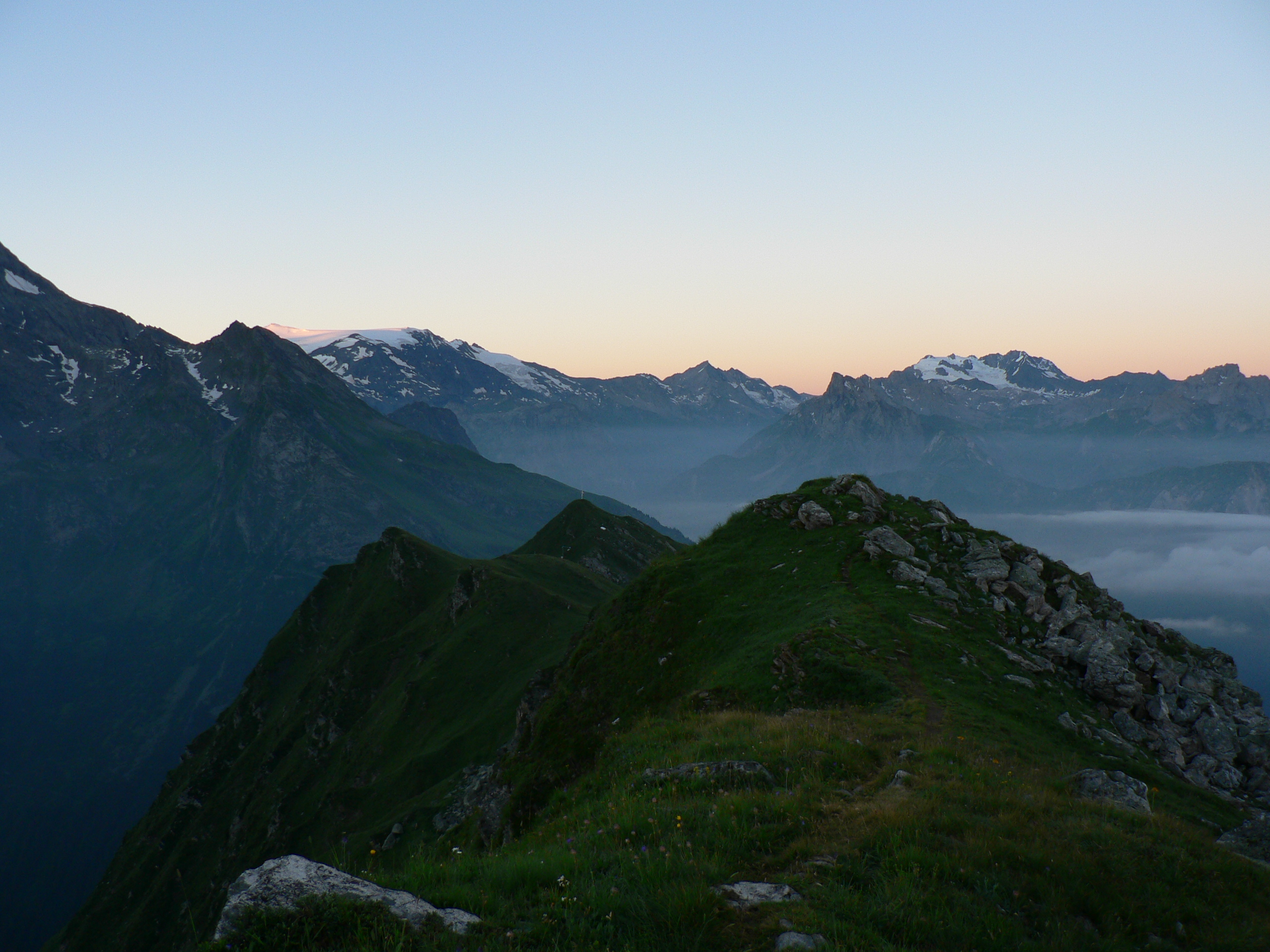
There was about 1000m of ascent from the valley base to the summit, and so I set off nice and early (4am) to make sure I was down in plenty of time to catch our bus at midday. This also had the added benefit that it was still nice and cool. The entire of my ascent was done under headtorch light, so I haven't much to say for the view! It was quite a drag with no reference frame other than a few steps in front of me. Fortunately, it started to get light when I reached the Col de la Bauche de Mio, which was at the start of the kilometre-long ridge running south to the summit. The ridge was mainly grassy but with a few rocky exposed steps to add a bit of excitement, and it was in an excellent position with grand views either side. On the east lay the sleepy valley of Champagny-le-Haut, with the ominous backdrop of Le Grand Bec, whilst to the west the view reached far out towards the Écrins. I was treated to a spectacular cloud-inversion to the west, which looked striking in the early-morning light.
Unfortunately I was a little bit too quick on the ascent to witness sunrise on the summit, but that did mean that I could make the most of the walk down and enjoy the views that I didn't have on the way up!
Petit Mont Blanc (2680m)
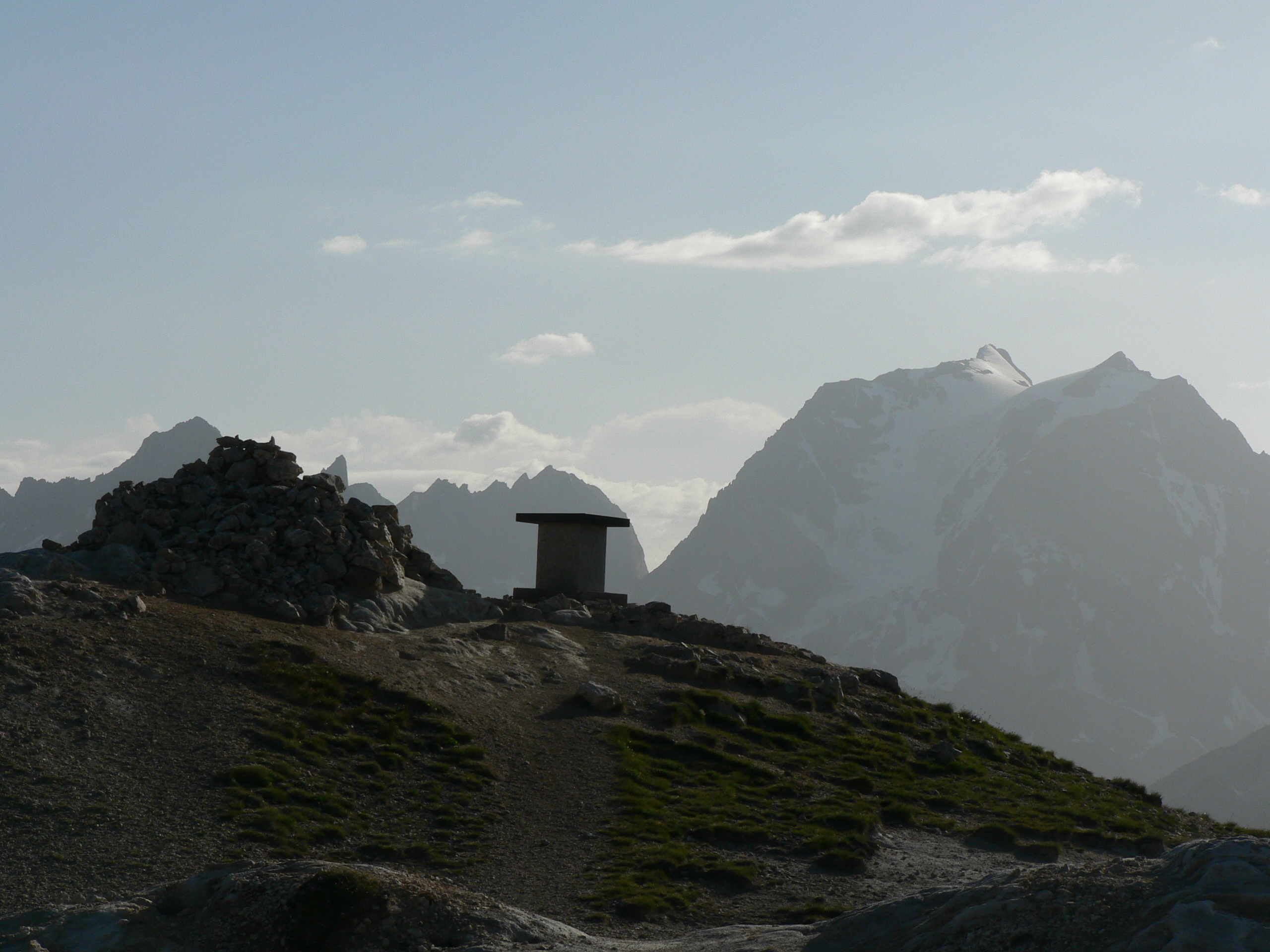
I've been up this mountain once before, on a holiday with my parents in 2005, and I made a point of returning as I remember thoroughly enjoying it the first time around. I'm not sure what gave me the idea to do it as a run instead of a walk, nor why I chose to do it the day after Dome de Sonnailles when my legs were still aching, but it definitely paid off! So, at 6am on Sunday, I found myself running up the track towards Les Prioux with a small bag containing a camera, one litre of water, windproof jacket, gloves, map and 300g of brioche. Similar to the previous morning (when we got rain on the summit of Dome de Sonnailles), a rather heavy shower passed through, but fortunately just as I had reached a particularly tree-covered part of the track, enabling me to take shelter. I reserved the first path up the mountain that I reached for the descent (which me and my Dad had descended 8 years prior), instead choosing the second route - the "sentier du foret" - a path that I hadn't been up before. The path zigzagged its way up the mountain for what seemed an eternity. It was excruciatingly runable; just at that angle that is too shallow to warrant walking but too steep to be comfortably runable. It took me an hour and forty minutes to ascend, only stopping once to re-tie my shoe laces. I spent a good few minutes on the summit admiring the views over to where we'd been in the previous week, eating my brioche and drinking most of the water, before heading off at speed to return back to the valley just within the "two hours from valley to summit and back" target I'd set myself.
I remembered the descent from 2005 as being steep, but I didn't remember it being quite as steep as it was! I struggled down in my Inov-8 fell shoes, which after a few years of solid use are becoming a little light on the tread. There was a fair bit of slipping and sliding, and a Lance Armstrong moment when I overcooked a corner and took the "short way" to the next zigzag through some bushes, but I eventually made it down in one piece. It was then just a case of struggling along the valley path back to the campsite for a cup of coffee and breakfast number two. Total time from campsite to summit and back: 2 hours 46 minutes.
Summit of Petite Mont Blanc, with La Grande Casse in the background
Crete du Mont Charvet (2362m) and Rocher de Villeneuve (2197m)
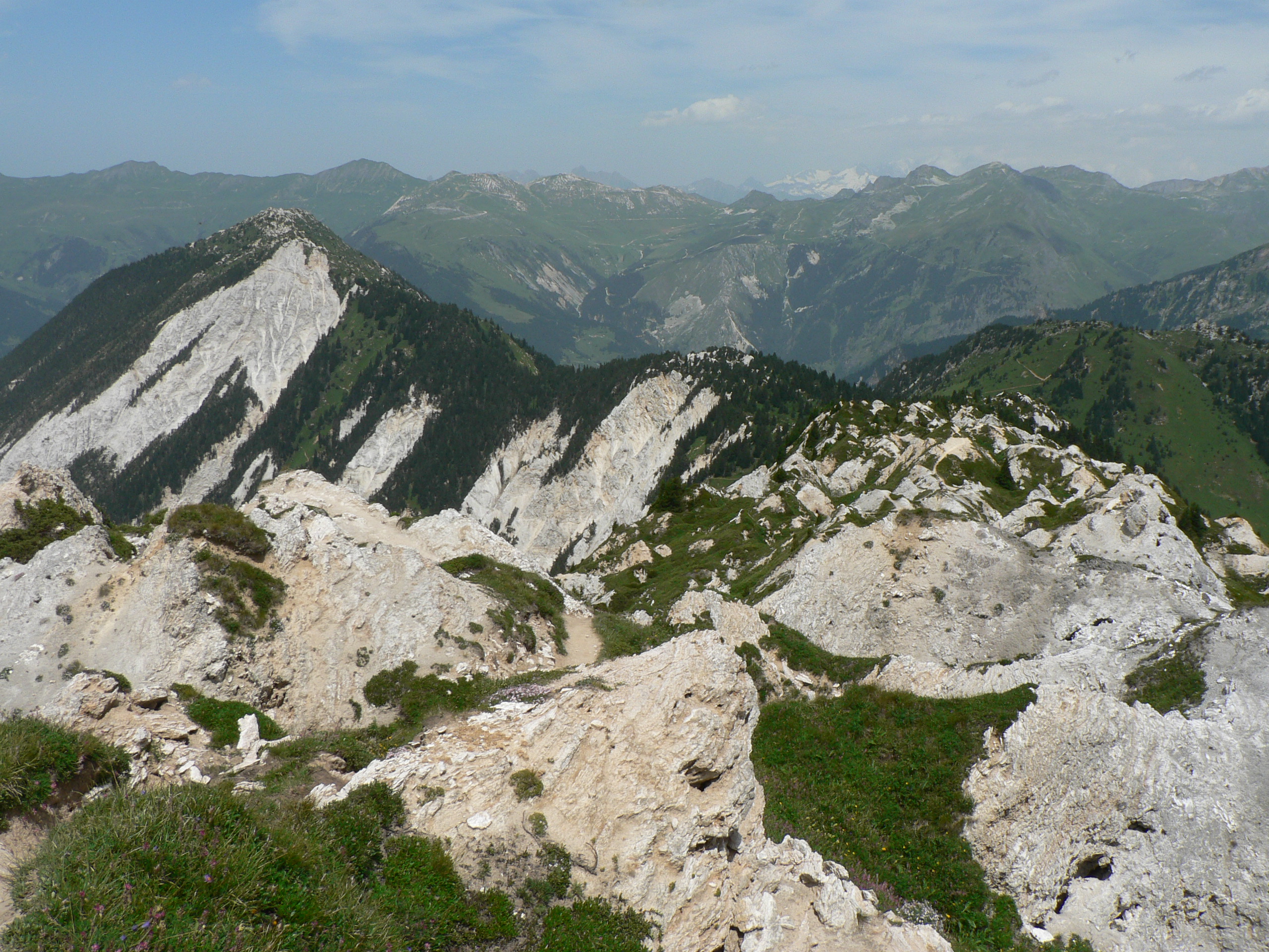
The day after Petit Mont Blanc, the forecast was for thunderstorms in the afternoon and so any Alpine summit attempts were off the cards. Instead, we decided to do a walk and hopefully be off any exposed ground for when the storms hit. The Crete du Mont Charvet, a long ridge running north from Dents de la Portetta, is visible from Pralognan and caught our attention as a possible route earlier in the week. After checking the map it seemed completely plausible to do a loop encompassing Col de la Grande Pierre, Crete du Mont Charvet and Rocher de Villeneuve.
We followed an array of yellow signs from Pralognan to Col de la Grande Pierre, which offered a choice of routes in a number of places. We chose the "sentier du foret" in hope of shade, though it actually turned out to be mainly a large forest track through quite open ground rather than the little forest footpath we'd been hoping for. All the routes converge near "La Montagne", a little mountain village sitting underneath Crete du Mont Charvet, before making the ascent of the Couloir de la Grande Pierre to the col of the same name.
The "col" is one of those Alpine cols that isn't really that much lower than its adjoining ridge, and we only had a few more metres of ascent to do to gain the high point of the day on the Crete. We worked our way day the path that wound its way in, over and around obscure lunar-esque terrain, comprising many quartz ridges and craters with pine trees popping up at random locations. Word or photos don't do justice to how unique and interesting the Crete was; you really have to see it for yourself!
We were soon down at the Col du Golet and quick dashed up Rocher de Villeneuve before the ominous looking thunderclouds reached us. As we gained the summit, huge growls of thunder could be heard and impressive fork lightening could be seen striking peaks ever-closer to ours. In reality, we had plenty of time to get off the exposed ground, but being struck by lightening in the Alps last year was still fresh on my mind and we didn't hang about on the descent. The rain hit just as we reached a few little chalets, under the eves of which we took shelter. Fortunately, the worst of the storm skimmed past where we were and so we only got a bit of a shower, before enjoying the refreshing walk back down to Pralognan.
Crete du Mont Charvet
Col de Napremont (2185m)
Immediately visible from Pralognan, rising in front of ominous Dents de la Portetta, is an opened topped grassy hill standing at 2185m. Whilst the hill is nameless on the map, the col between it and the aforementioned Dents is labelled the Col de Napremont, and it seems to me at least that this is the name used to refer to the hill as well. We'd been eyeing it up for a while and on one rainy morning I decided it was time to have a quick run up it. The plan was to approach it from the south and descend on the north side. However, after firstly running far too far up les Prioux valley and having to retrace my steps, I found a sign saying my chosen route was "closed" and had been for a number of years; they obviously haven't updated the maps yet! A good path lead from here up through the Bois de la Cholliere, and I'll leave it up to you to determine whether I obeyed the sign or not. However, for future reference, I would strongly advise anyone visiting to col to definitely obey the sign - whether I'm advising that from having been up it and regretting my decision, or simply looking down from the col over the extra-steep waist-high grassy slopes to the south, is your guess!
The northern route to the col was surprisingly varied, and a few days later, on another rainy afternoon, Lorna and myself went for a walk up there. It starts off by winding its way up through the forest, before throwing you out onto open slopes above on a zigzagging path that takes everything from boulder-strewn hillside to dense vegetation. We didn't have much of a view when we reached the top, but somehow that didn't really matter as the clouds shrouded the neighbouring hills made for an equally as impressive view.
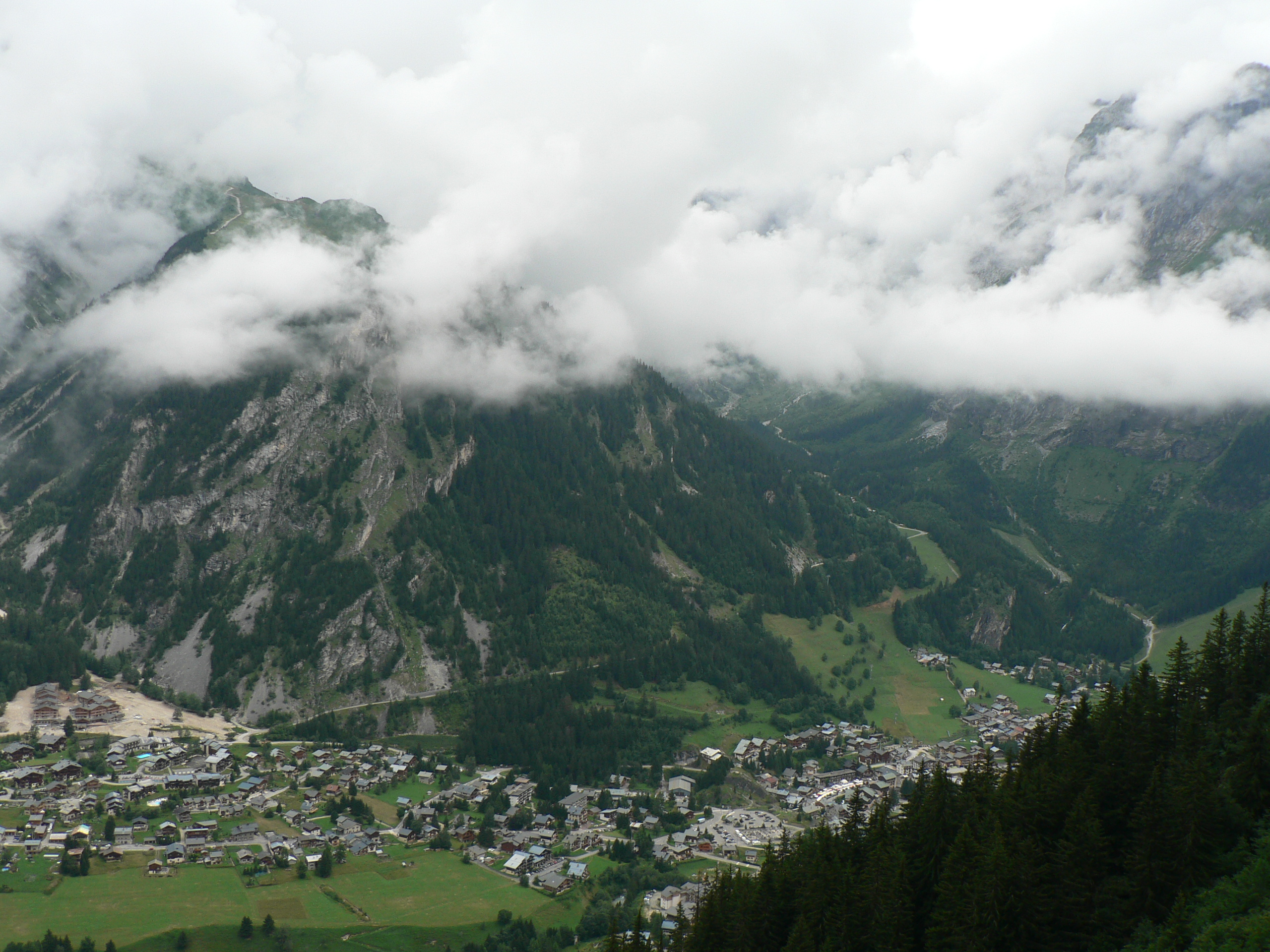
View back down to Pralognan
Pointe de la Véliere (2467m)
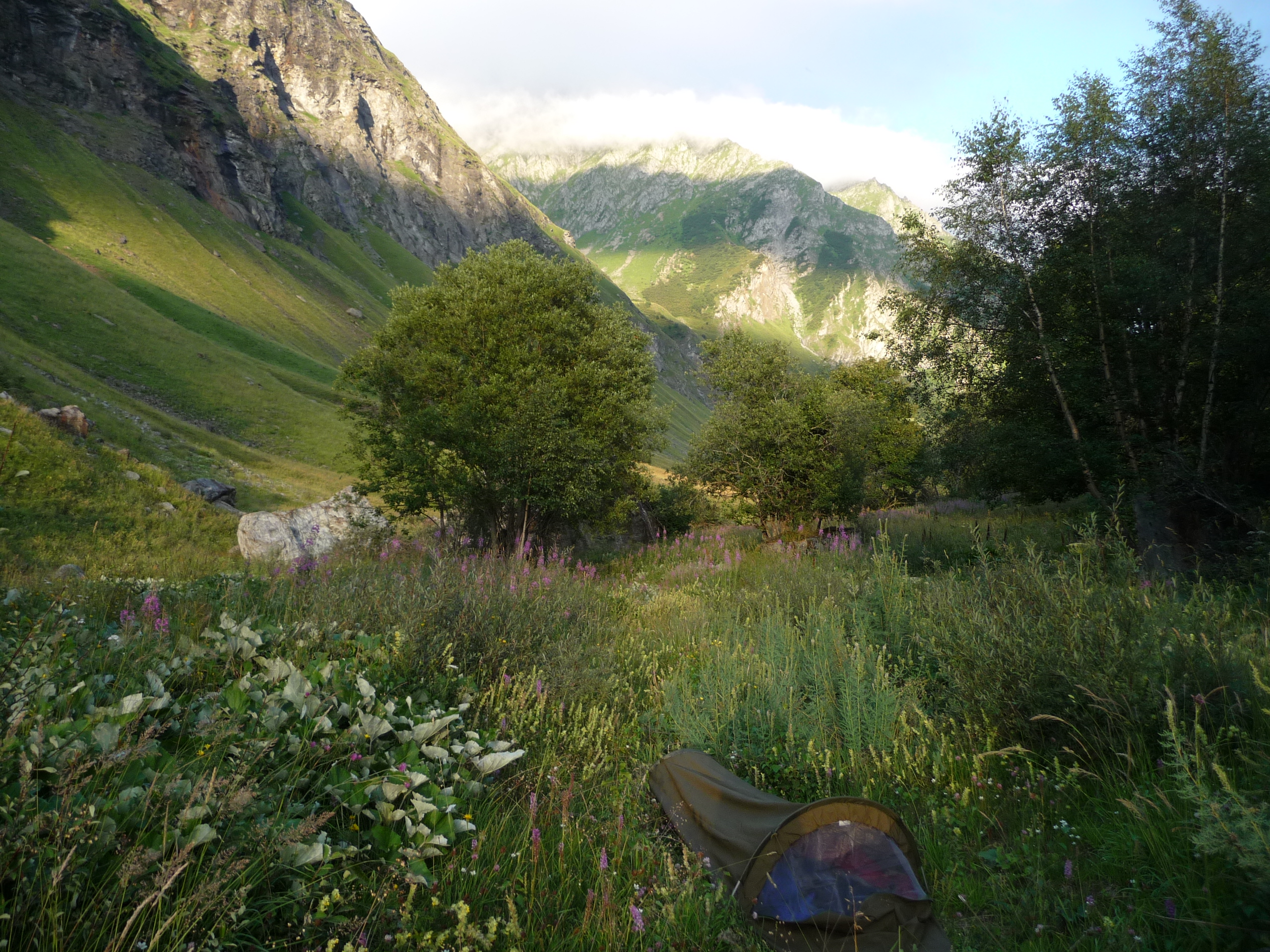
The weather turned good once more for our final weekend in Pralognan, and so we decided to catch the bus to the neighbouring valley of Champagny to attempt Sommet de Bellecote. Unfortunately, however, Lorna's long-term hip injury started playing up on the walk in to the Refuge de Plaisance, and so instead we opted for a bivvy in the valley and the following morning I went for a walk up Pointe de la Véliere before we caught the bus back.
There was about 1000m of ascent from the valley base to the summit, and so I set off nice and early (4am) to make sure I was down in plenty of time to catch our bus at midday. This also had the added benefit that it was still nice and cool. The entire of my ascent was done under headtorch light, so I haven't much to say for the view! It was quite a drag with no reference frame other than a few steps in front of me. Fortunately, it started to get light when I reached the Col de la Bauche de Mio, which was at the start of the kilometre-long ridge running south to the summit. The ridge was mainly grassy but with a few rocky exposed steps to add a bit of excitement, and it was in an excellent position with grand views either side. On the east lay the sleepy valley of Champagny-le-Haut, with the ominous backdrop of Le Grand Bec, whilst to the west the view reached far out towards the Écrins. I was treated to a spectacular cloud-inversion to the west, which looked striking in the early-morning light.
Unfortunately I was a little bit too quick on the ascent to witness sunrise on the summit, but that did mean that I could make the most of the walk down and enjoy the views that I didn't have on the way up!
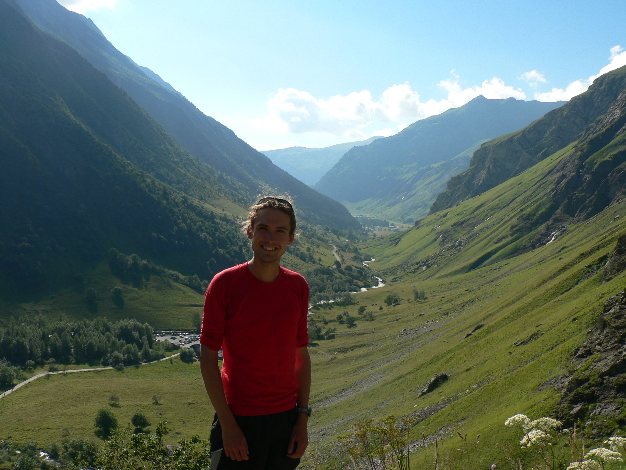
Looking back down the Champagny valley
Lovely bivvy spot for the evening! (Don't worry, we were outside of the National Park).
Fantastic clouds! To the east of the ridge.
The ridge itself